Delve into insights from Mattias Tidebrink, SVP, APAC, Hexagon’s Safety, Infrastructure and Geospatial Division, as he discusses the collaborative efforts with Fujitsu to advance digital twin solutions for resilient urban environments.
Could you provide us with an overview of the joint development between Hexagon and Fujitsu for digital twin solutions? What challenges had the partnership been born from?
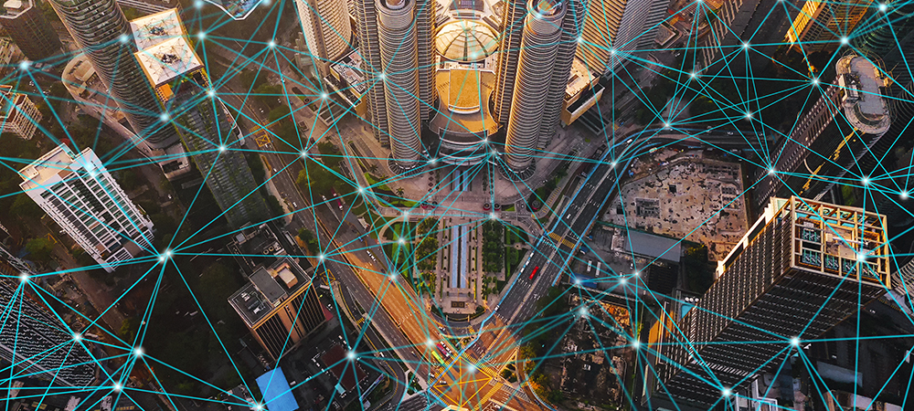
The business alliance between Hexagon’s Safety, Infrastructure and Geospatial division and Fujitsu Limited was initiated in June 2022 to support both companies’ ongoing efforts to realise resilient and disaster-resistant cities. The partnership aims to help make urban areas more sustainable and liveable by monitoring and mitigating challenges that have negative impacts on society.
A major challenge faced by city officials and agency leaders is how they can make the most out of the data that they have. Data often sits in silos across different organisations, making it hard to put together and gather insights. Through digital twin technology, we can help them draw meaningful insights and bring data to life that can be used to inform actions.
Essentially, city leaders want to optimise the public services they are providing, such as improving the flow of traffic and enhancing public safety. The joint development of these digital twin solutions, in particular, aims to support disaster mitigation by tackling issues such as flooding and developing safer and more resilient transportation networks.
With the rise in extreme weather events causing disruptions in critical services and infrastructure, how do digital twin solutions empower decision-makers to make more informed and timely choices, especially in sectors like public safety, utilities, and transportation?
Digital twins can empower decision-makers in a number of ways by leveraging the power of data. Real-time and historical weather data and digital elevation models are used to better understand and predict natural incidents like flooding, landslides and more. For places such as industrial complexes, ageing buildings, bridges and public transit lines, a digital twin transforms data into insights that include safety, sustainability, traffic flow and impact and investment justification, among others.
Additionally, decision-makers are able to detect flaws within systems and allocate resources strategically, increasing the efficiency of emergency responses and minimising downtime in utilities and transportation. With remote operation capabilities, digital twins enable infrastructure control even when physical access is restricted due to inclement weather. A more collaborative approach is possible with the seamless exchange of real-time data, simulations, and insights amongst many stakeholders, such as governmental organisations, utility companies, transportation authorities and emergency services.
This improves overall response capability and guarantees a coordinated effort to lessen the impact of severe weather occurrences on vital infrastructure and services.
In the context of Southeast Asia, where climate change is expected to cause havoc, how do Hexagon’s solutions specifically address the challenges faced by governments and cities in the region?
Southeast Asian countries must invest in climateproofing and building resilience to address the challenges posed by climate change. Through digital twin solutions, decision-makers can see how certain changes might impact the city before any actions are taken, drastically reducing costs.
One of the issues faced by cities is water management. As global climate change exacerbates heat waves and air pollution in the region, several cities in Southeast Asia saw blistering temperatures earlier this year with some experiencing record-high temperatures. For instance, Bangkok, the capital city of Thailand, recently experienced a dangerously high heat index of 50.2℃, according to the Thai Meteorological Department.
With climate change triggering heat waves across Southeast Asia, the optimisation of rainwater collection becomes more important. The issue with doing so is that towns and cities have built up concrete pavements preventing adequate rainwater absorption. This leads to overwhelmed drains and urban flooding during heavy rainfall causing potential damage to homes and businesses. Cities can use Hexagon’s digital twin technology to automate yearly inspections to track changes and locate areas of concern that could be modified or replaced with green solutions. These tools may also be used to quickly find illegally built paved constructions that need to be torn down.
To determine flood-prone areas and mitigation options, sensors can detect water flow and determine where obstructions and leaks are located. The urban digital twin also allows officials to determine which homes are at risk and their insurance values by combining data from insurance firms. This is beneficial for estimating potential financial loss from floods.
Beyond the technological advancements, could you share a story or example that illustrates how Hexagon’s solutions have directly impacted the lives of individuals or communities, helping them better cope with the challenges posed by natural disasters or climate change?
Hexagon and Fujitsu recently collaborated to develop a digital twin platform to assist the urban digital twin project in the German city of Stuttgart, which aims to promote sustainability and enhance the quality of life for its 600,000 citizens. The City’s Civil Engineering Office will utilise our Software as a Service (SaaS) solution to visualise and analyse data from Internet of Thing (IoT) sensors located around the city.
The solution offers a unified operational view for monitoring sensor data, such as water quality, flood levels and parking space occupancy, allowing the city to gain insights for operational optimisation and future decision-making. Hexagon’s M.App Enterprise and Xalt |Integration solutions served as the foundation for the digital twin platform, and Fujitsu provided the project’s essential cloud infrastructure service.
The effects of climate change can often disproportionately affect vulnerable populations. How do Hexagon’s initiatives and digital twin solutions ensure that the most at-risk communities receive the support and resources they need during times of crisis?
We help vulnerable communities address their most pressing urban challenges, such as sustainability, safety and mobility, by helping them leverage and analyse real-time data, and putting that information to use to provide for the safety and well-being of their communities. For instance, leaders from at-risk cities can leverage our digital twin solutions to:
- Set priorities: Determining where to start and how to prioritise and allocate available funds
- Take unified action: Maintaining a view of all initiatives, and making sense of data to implement solutions based on city-wide analysis
- Monitor outcomes: Deriving insights for optimising operations and making well-informed decisions for the future
In doing so, city leaders can better anticipate, support, and provide for the needs of their citizens.
Collaboration between Hexagon and Fujitsu demonstrates the power of technological partnerships. Could you shed light on the synergies between the two companies and how this collaboration amplifies the impact of the digital twin solutions?
Our collaboration utilises digital twin technologies and solutions from both companies, including IoT sensors, data processing, AI analysis and advanced data visualisation in the cloud and high-performance computing infrastructure.
This includes leveraging Fujitsu’s Computing as a Service (CaaS) capabilities under the Fujitsu Uvance brand which combines world-leading computing technologies via the public cloud and Fugaku, the world’s fastest supercomputer, in synergy with Hexagon’s M.App Enterprise.
M.App Enterprise is a cloud platform for creating geospatial apps. The platform allows city planners to easily monitor real-world changes, evaluate the impact, and act on the results. M.App Enterprise provides a unified geospatial enterprise platform that enables customers and partners to configure vertical solutions for their markets and industry segments.
For example, working together, we help protect cities and regions from natural disasters such as flooding by using “digital rehearsal” technology to analyse and verify disaster threats and optimal disaster preparedness in advance on a digital twin that replicates real-world conditions with incredible detail.
Using flood forecasting models and precipitation data, we can perform sophisticated calculations and visualise flooding, as well as address challenges in the medical, financial, public and distribution spheres, such as infrastructure damage forecasting, formulation of disaster response plans and estimation of damage amounts.
Together, we can help city planners secure safe evacuation routes and support infrastructure protection in the event of abnormal weather and natural disasters by leveraging weather IoT sensors and weather forecast services that monitor temperature and rainfall.
Looking ahead, as the frequency and severity of natural disasters continue to rise due to climate change, how do you envision the role of technology, such as digital twin applications, evolving to ensure the resilience and sustainability of critical services and infrastructure in cities?
According to the World Meteorological Organisation (WMO), Asia is the world’s most disaster-prone region, making it all the more imperative that leaders here leverage technology to mitigate the effects of climate change and ensure the resilience and sustainability of critical services and infrastructure of their cities.
However, climate change is only understood because of geospatial data. Geospatial data describes objects or events with their location. Think of yearly comparisons of water levels or consider data that is collected and shared in real-time while monitoring the spread of weather events, such as a hurricane, or natural disasters, such as a wildfire.
Without geospatial data science, we would not know the extent of the climate crisis and how quickly it is evolving. Digital twins of cities are an essential tool in the battle against climate change, allowing city leaders and urban planners to optimise energy efficiency at every stage of developing and managing infrastructure.
By creating 3D digital twins, we can support the need for geospatial data that enables insightful, data-driven decisions. Digital twins will enable city leaders and infrastructure planners to manage and monitor critical assets, assess and model risks, and support the visualisation of new infrastructure projects with the goal of creating smarter, more sustainable cities, not just in this region, but around the globe, and better weather the effects of climate change.